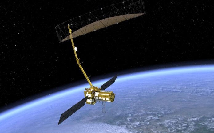
Washington: After numerous delays, NASA has confirmed that the world’s most advanced and costly Earth observation satellite, NISAR, is expected to launch in March 2025. The satellite, developed jointly by India and the United States over the past decade, was originally scheduled for a 2024 launch.
In an official statement, NASA revealed, “NASA and ISRO are looking at a likely launch date in March 2025. Short for NASA-ISRO Synthetic Aperture Radar, NISAR will scan nearly all of Earth’s land and ice surfaces twice every 12 days, measuring changes in the planet’s ecosystems, land and sea ice, and solid Earth. The satellite will launch from the Satish Dhawan Space Centre on India’s southeastern coast.”
Weighing in at 2.8 tonnes, the NISAR satellite was conceived following a 2014 agreement between India and the US. It is designed to monitor planetary changes with unparalleled precision. The satellite’s estimated cost exceeds Rs 5,800 crore, marking it as the most expensive of its kind. Notably, NISAR is the first satellite in the world to feature dual-frequency radar: NASA’s L-band (1.25 GHz) and ISRO’s S-band (3.20 GHz), delivering unmatched data accuracy. The mission’s critical components were shipped from the US to India in October 2024, a significant logistical achievement. However, the project faced delays due to technical issues related to its 12-meter radar antenna reflector.
The data generated by NISAR will prove invaluable for managing natural resources and addressing environmental hazards. It will also assist scientists in understanding the pace and effects of climate change. The satellite will enhance knowledge of Earth’s outer crust, shedding light on its solid structure.
Also Read | Lilly Obesity Drug Mounjaro to Be Offered in Britain’s NHS After Watchdog Nod
Observations from NISAR will help scientists better comprehend changes in Earth’s surface, including glaciers, ice sheets, and sea ice. It will also track changes in forest and wetland ecosystems, and monitor movements of the Earth’s crust, including earthquakes, landslides, and volcanic activity. NASA highlighted the satellite’s potential to aid disaster response, producing data that can assess damage and mitigate impacts by providing pre- and post-disaster observations within short time frames.
Also Read | Israeli Minister Admits to Assassination of Hamas Leader Ismail Haniyeh
NISAR’s capabilities are truly cutting-edge. It will generate high-resolution images using radio signals, operate effectively in darkness and challenging weather conditions, detect surface changes as small as one inch, and penetrate dense vegetation for comprehensive mapping.


