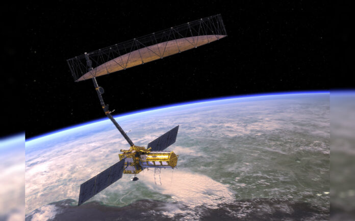
New Delhi/Washington: The Indian Space Research Organisation (ISRO) is preparing to launch the highly anticipated NASA-ISRO Synthetic Aperture Radar (NISAR) mission in March from the Satish Dhawan Space Centre in Sriharikota. This ambitious collaboration between NASA and ISRO is poised to revolutionize Earth observation with its innovative dual-band radar technology.
A Game-Changer in Earth Observation
NISAR will be the world’s first satellite to utilize dual-band radar technology, equipped with both L-band and S-band wavelengths. This unique system enables the satellite to observe Earth’s dynamic surface with unparalleled precision and frequency. According to Paul Rosen, project scientist for NISAR at NASA’s Jet Propulsion Laboratory (JPL):
“NISAR will measure Earth’s surface changes every week, with each pixel capturing an area about half the size of a tennis court. This frequency and resolution will help us create a cohesive narrative about the planet as a living system.”
What NISAR Will Accomplish
NISAR is designed to provide critical data for a wide range of applications, including:
- Tracking Land Deformation: Monitoring surface changes caused by earthquakes, landslides, and volcanic activity, which can aid in disaster response and scientific research.
- Studying Climate Change: Observing glacier movements, ice sheet dynamics, and forest changes to shed light on the global carbon cycle.
- Ecosystem and Resource Management: Assisting in monitoring wetlands, water resources, and agricultural activity to support sustainable practices.
The satellite’s dual-band system enhances its ability to study different aspects of Earth’s surface. The L-band, with a longer wavelength, detects large structures like tree trunks and boulders, while the S-band identifies finer features such as leaves and rough terrain. Together, these bands offer a comprehensive and multi-dimensional perspective of the planet.
A Milestone in International Cooperation
NISAR’s development is a testament to the strength of international collaboration. The mission evolved from NASA’s proposed DESDynI satellite and ISRO’s advancements in S-band radar technology. Formalized in 2014, the partnership brought together expertise from across continents, time zones, and over 9,000 miles. The satellite’s assembly in India symbolizes a milestone in global cooperation and technological exchange.
Also Read | Another Mi-28N ‘Night Hunter’ Shot Down, Pilots Lost
Data for Everyone
NISAR’s data will be stored in the cloud and made freely accessible to researchers, governments, and organizations worldwide. Applications will range from ecosystem monitoring to managing water resources, marking a significant step forward in making Earth science data more inclusive and impactful.
A New Era of Earth Science
As the countdown to launch begins, NISAR promises to redefine Earth observation. With its groundbreaking technology and global accessibility, the mission will equip humanity with the tools to better understand and protect our ever-changing planet.


